Sunset Peak
Los Angeles National Forest
|
|
click photo to enlarge |
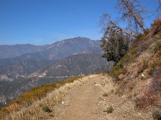
This is our first serious hike of the year. This was a nice one to start out with
as it is was the easiest one we have taken in the area. It was 7 miles round
trip but only climbed about 1300 feet. The hike was along a forest road. I
heard more birds along this hike then any hike we have taken.
|
click photo to enlarge |
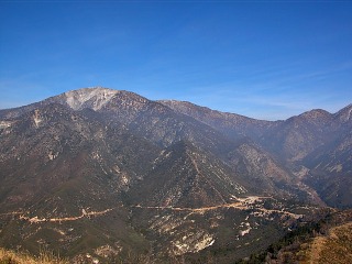
If you enlarge this photo in the area to the lower right is an RV camp area.
We have not been to this yet as many times the gate is locked. The area
called Cow Saddle where we parked is just to the right of that.
|

click photo to enlarge |
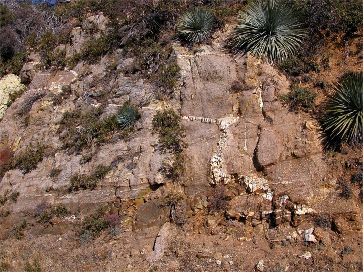
This picture shows a quartz vain in the rocks. There was some gold mined
in these mountains but there was not a lot. Gold is often found in quarts
veins like this. But I included the picture because you see a fault line.
The way the vein drops is due to a fault.
|

click photo to enlarge |
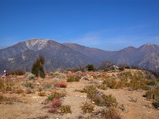
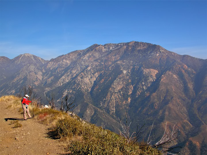
The flatter topped mountain on the right side of this photo is Ontario
Peak at 8693 feet. Just to the left of it is Telegraph Peak at 8985 feet.
Timber Mountain is in with Ontario and it is hard to distinguish it from
Ontario.
|
click photo to enlarge |
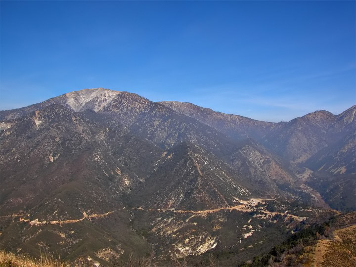
This large flat area is Sunset Peak at 5796 feet. The largest of the peaks in
the San Gabriel's is in this picture on the left. It has a little bit of snow
at the top. This is Mount San Antonio or Baldy and no Mike it isn't named
after me. Directly in front of it is Lookout Mountain. Just peeking out to the
right of it is Mount Harwood. Then the ridge dips down to what is called the
Baldy Notch. To the right of the notch is Thunder Mountain then Telegraph
Peak.
|
|
|
|
|
|
|
|
|

